NYC Tornado Warning: Severe Storms and Heavy Rain Incoming
New York City is bracing for a severe weather threat today, with heavy rain, thunderstorms, and even the possibility of tornadoes. The National Weather Service (NWS) has issued a warning for much of the day.
<img src="https://static.fox5ny.com/www.fox5ny.com/content/uploads/2025/09/nado.jpg" alt="NYC weather forecast">Key Impacts:
- Damaging Wind Gusts: Expect strong winds throughout the day and into the evening.
- Flooding Rain: Heavy rainfall could lead to localized flooding, especially in urban areas with poor drainage. The NWS predicts 1 to 2 inches of rain.
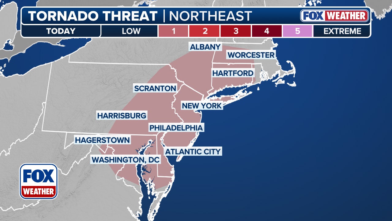
- Tornado Risk: While the overall risk is low, some storms could potentially produce tornadoes.
Timeline:
- Thursday: Showers and thunderstorms likely between 8 a.m. and 5 p.m., with a continued chance of showers and thunderstorms after 5 p.m. High near 76°F. Severe storm and flash flood potential from 3 p.m. - 10 p.m.
- Thursday Night: Showers and thunderstorms before 2 a.m., then a chance of showers. Low around 70°F.
What to Expect:
The Storm Prediction Center has placed the Tri-State area at a Level 1 out of 5 severe thunderstorm risk, meaning isolated severe thunderstorms are possible. Flooding is a major concern due to the potential for heavy rain.
<img src="https://images.foxtv.com/static.fox5ny.com/www.fox5ny.com/content/uploads/2025/09/932/524/nado.jpg?ve=1&tl=1" alt="Tornado threat graphic">Looking Ahead:
A cold front will move through on Friday, ending the rainy weather.
For detailed updates and radar information, check here.


Comments
Join Our Community
Sign up to share your thoughts, engage with others, and become part of our growing community.
No comments yet
Be the first to share your thoughts and start the conversation!