DOT opens planning for a 15-mile Bronx waterfront greenway; first workshop Nov. 4 in Hunts Point
The route would run from Randall's Island to SUNY Maritime. Brooklyn, Staten Island and southern Queens greenways get their own workshops starting next year.
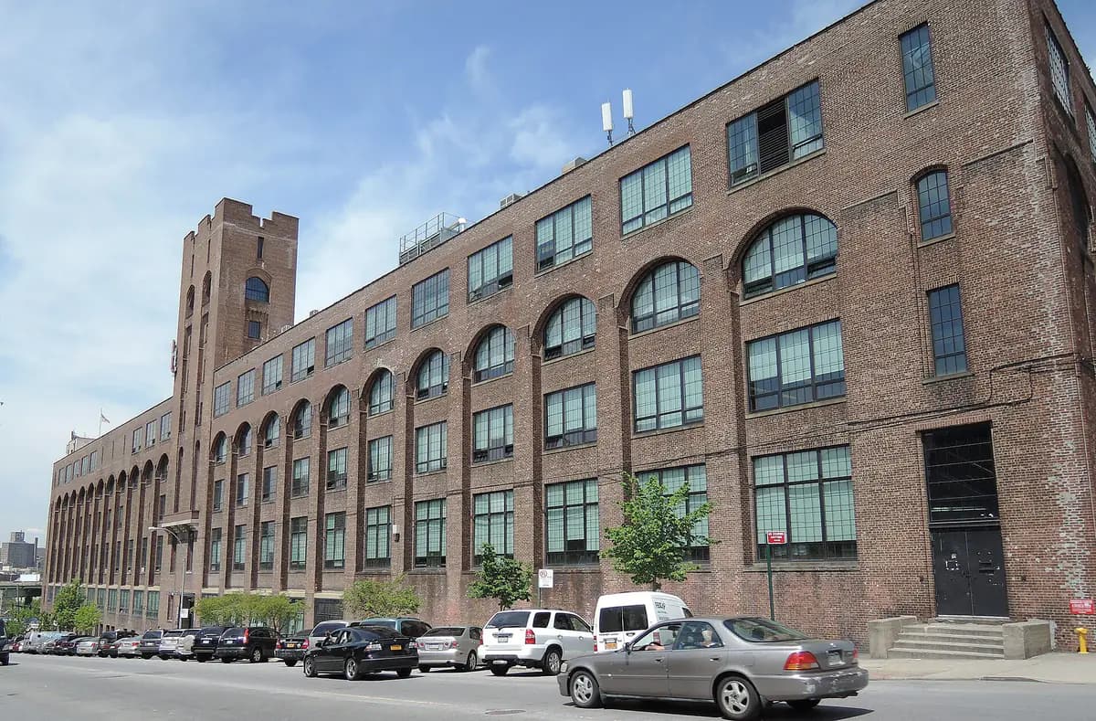
Photo: Jim.henderson / Wikimedia Commons · CC0
- The city Department of Transportation is starting public planning for a roughly 15-mile Bronx Waterfront Greenway from Randall's Island east to SUNY Maritime near the Throgs Neck Bridge, amNY reported.
- DOT's website lists the first in-person workshop for Wednesday, Nov. 4, 6 to 8 p.m., at the BankNote Building, 1231 Lafayette Ave., Hunts Point, and a virtual session Thursday, Dec. 3, 6 to 8 p.m.
- Registration for one or both sessions is online through the DOT greenways page.
- Three more plans follow starting next year: a 12-mile Brooklyn link from Coney Island to Highland Park, a 10-mile Staten Island North Shore route and a southern Queens connection toward JFK.
- The planning is paid for by a $7.25 million federal RAISE grant awarded in 2022.
Bronx residents get the first say on a long-planned walking and biking route along the borough's southeastern shoreline. The city Department of Transportation is opening public planning for the Bronx Waterfront Greenway, a roughly 15-mile path from Randall's Island east to SUNY Maritime, below the Throgs Neck Bridge, amNY reported Monday.
Greenways are continuous paths for cyclists and pedestrians that run between roads, parks and the waterfront, away from car traffic. The Bronx route is meant to make it easier and safer to commute to job centers like Hunts Point and to link waterfront parks in Soundview and Throggs Neck, according to DOT.
How to weigh in
The first round of workshops focuses on existing conditions. DOT wants specific comments, concerns and ideas. The agency's greenways page lists:
- In person: Wednesday, Nov. 4, 6 to 8 p.m., The BankNote Building, 1231 Lafayette Ave., Bronx, NY 10474 (Hunts Point)
- Virtual: Thursday, Dec. 3, 6 to 8 p.m.
You can register for one or both on the DOT greenways page. amNY's early report gave different times (4 to 6 p.m., with a virtual session the next day), so check the registration form before you go.
Three more routes next year
The Bronx plan is the first of four new outer-borough greenway plans, and DOT says it will run community planning for all of them through fall 2027. Workshops for the other three start next year, amNY reported:
- Historic Brooklyn Greenway (about 12 miles): fills gaps between the Ocean Parkway and Eastern Parkway bike paths, the oldest in the country, to connect Coney Island with Highland Park. DOT says it will also link Broadway Junction.
- Staten Island Waterfront Greenway (about 10 miles): runs the length of the North Shore, from the St. George ferry terminal to the Goethals Bridge.
- Southern Queens Greenway: extends the Jamaica Bay Greenway east and makes JFK Airport easier to reach by bike and on foot.
These are part of six "early action" plans by DOT, NYC Parks and the city's Economic Development Corporation that will add more than 40 miles to the network, amNY said. The plan for the Bronx's Harlem River waterfront is already complete, and northern Queens is underway. All six are funded by a $7.25 million federal RAISE grant awarded to the city in August 2022, according to DOT.
"I encourage everyone to make your voices heard," DOT Commissioner Mike Flynn said in a statement quoted by amNY.
- amNYFIRST ON amNY: DOT will begin collecting public input on 4 new outerborough greenway projects next week
- NYC Department of TransportationGreenways
Every story links to the reporting and records it’s based on. Our editors write each piece from public reporting and official data, and check it against those sources before it’s published.
Comments
0NSynced with CommunityIn CommunityYour comment is also posted to Community with this story attached, so neighbors can find it and reply there too.
No comments yet
Start the conversation — your comment shows up here and in Community for neighbors nearby.