Parks asks Bronx residents to weigh in on flooding and road fixes in Pelham Bay Park, the city's biggest park
A Parks Department study has flagged eight flood-prone spots, from Pelham Parkway to the City Island Bridge and the Orchard Beach lot. Its findings will steer future spending, and the online survey is open through the end of the year.
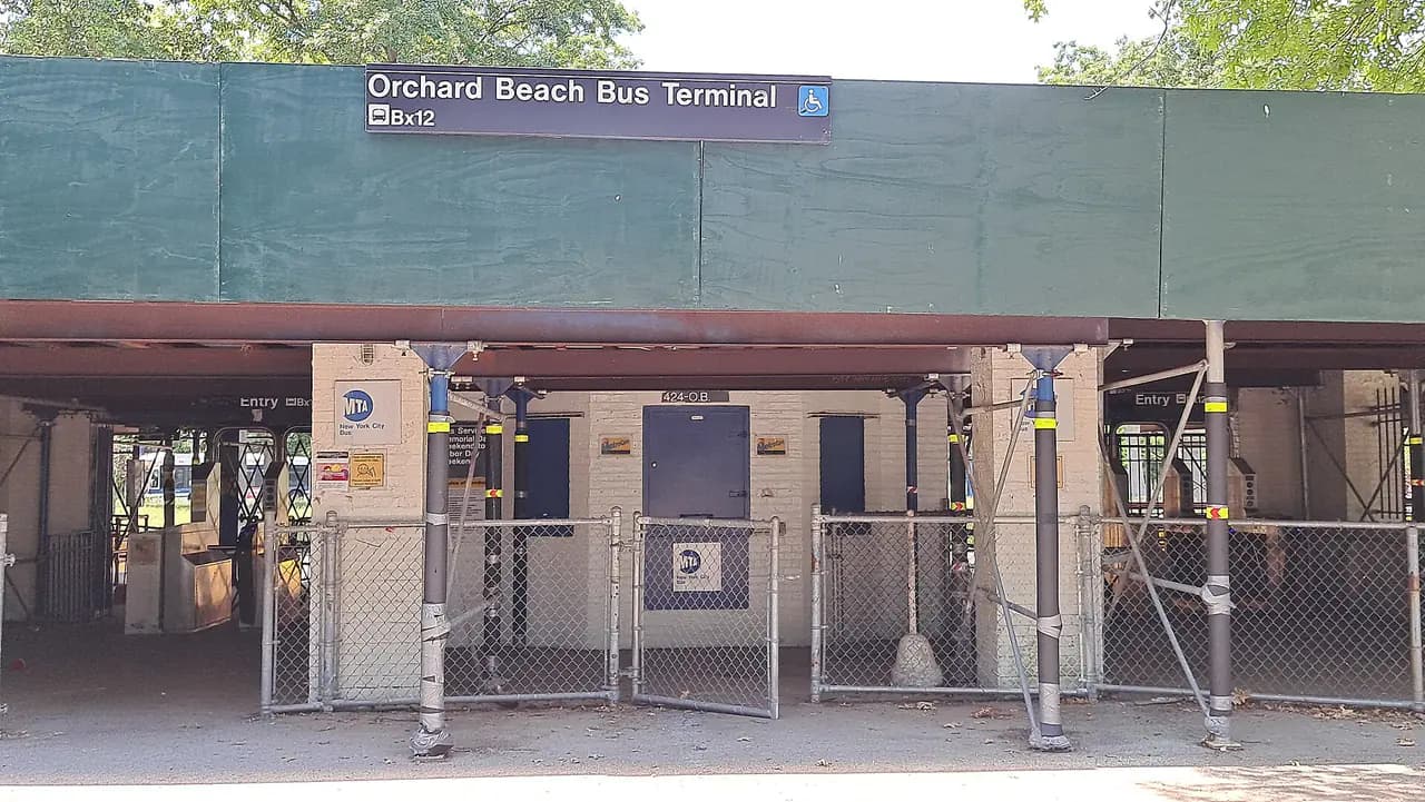
Photo: Transitsylveonkpop / Wikimedia Commons · CC BY-SA 4.0
- NYC Parks and the firm Starr Whitehouse are studying Pelham Bay Park's roads, greenways, bus stops and flooding to guide future capital projects. An online survey is open (NYC Parks, Bronx Times).
- The eight flood-prone areas: Pelham Parkway, the Hutchinson River Parkway, Shore Road, Orchard Beach Road, City Island Road, the City Island Bridge, the golf course lot and Park Drive (Bronx Times).
- Parks found cracks, potholes, uneven pavement and faded striping. Flooding can cut road access to City Island, including for emergency vehicles (Bronx Times).
- Seven bus routes and 22 stops serve the park. Parks is working with the MTA, and the study will feed a future plan to renovate the closed Orchard Beach bus terminal (Bronx Times).
- City Island Rising is urging residents to respond before the survey closes at the end of the year (Bronx Times).
The city wants to hear from people who drive, bike, ride the bus or walk through Pelham Bay Park, especially where the water keeps coming up. NYC Parks and the landscape architecture firm Starr Whitehouse are developing an access study that will guide future capital improvements to the park's roads, greenways and bus stops, its flooding and climate resiliency, and the overall visitor experience, according to the Parks Department. Residents are being urged to fill out an online survey, the Bronx Times reported.
At 2,772 acres, Pelham Bay Park is the city's largest park, more than three times the size of Central Park, with a 13-mile shoreline on Long Island Sound, Parks says. The park also connects City Island to the Bronx mainland, the Bronx Times noted.
Eight trouble spots
At a Sept. 29 meeting of the community group City Island Rising, Parks officials showed how coastal storm surge could swamp large parts of the park while routine tidal flooding already hits smaller stretches of shoreline, the Bronx Times reported. The study focuses on eight areas:
- Pelham Parkway
- The Hutchinson River Parkway
- Shore Road
- Orchard Beach Road
- City Island Road
- The City Island Bridge
- The golf course parking lot
- Park Drive, including the Orchard Beach parking lot
Parks planner Laura Melendez said at the meeting that high tides already affect many of the key areas, pointing to the flooding from the late-September nor'easter. "We're really trying to think of recommendations that will kind of solve a lot of these ponding and flooding issues," she said.
Roads, bikes and buses
The study grew out of an earlier capital planning study of Shore Road, which Parks expanded to cover roads throughout the park. The agency has already found cracks, potholes, uneven pavement and faded striping that make getting around hard for drivers, cyclists and pedestrians, the Bronx Times reported. When roads flood, access to City Island, home to about 4,500 people, can be cut off, including for emergency vehicles.
Seven bus routes with 22 stops serve the park: the Bx5, Bx12 (which runs to Orchard Beach in summer), Bx23, Bx24, Bx29, the BxM8 express and Westchester's Bee-Line BL45. Parks is working with the MTA to make the stops safer and more accessible, and the study will inform a future proposal to renovate the closed Orchard Beach bus terminal, according to the Bronx Times.
How to weigh in
The survey on the Parks website asks people to drop pins on a map and comment on specific spots. City Island Rising, which has been promoting it, says the survey closes at the end of the year. "The more that can be done to get people to participate in this study, will kind of send a signal to the power brokers down at City Hall that this is a priority not just for City Island but for the Bronx at large," board member John Doyle told the Bronx Times.
- Bronx TimesBronx residents urged to weigh in on flooding risks around Pelham Bay Park
- NYC ParksPelham Bay Park Access Study
- NYC ParksPelham Bay Park
Every story links to the reporting and records it’s based on. Our editors write each piece from public reporting and official data, and check it against those sources before it’s published.
Comments
0NSynced with CommunityIn CommunityYour comment is also posted to Community with this story attached, so neighbors can find it and reply there too.
No comments yet
Start the conversation — your comment shows up here and in Community for neighbors nearby.